Islamic Sects in Arabia 1918
From: EGP460.00
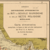
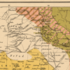
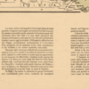
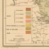
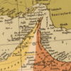
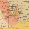
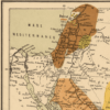
This Italian Kharita™ illustrates the distribution of religious affiliation in the Muslim populations of the Middle East. It shows the locations of adherents to the four schools of Sunni belief and the distribution of Shia populations. Where it is impossible to portray this diversity visually, the sheet provides a few paragraphs of further explanation, such as on the Senussi order in Medina, the Maliki school of Islamic law in Syria, and the Hanafi school as the official law of the Ottoman provinces.
The map is rich in detail, and shows a profusion of small towns and villages. Deserts or areas “of low culture” such as the Arabian Desert, the Sinai, and the Eastern Desert of Egypt are shown as white space. Information on the map is given as of September 1918. The map covers the area from Homs (Syria) and Chermansciah (present-day Kemanshah, Iran) in the north to the entire Arabian Peninsula in the south and east. The map was created by the prolific Italian cartographer Achille Dardano (1870-1938) and annotated by Carlo Alfonso Nollini (1872-1938), a scholar who was at one time the professor of famous Egyptian writer Taha Hussein. The map was photolithographed by the Italian Ministry of Colonies.
Map Info
Creator: Nollini, Carlo Alfonso, Dardano, A. (Achille)
Date: 1918
Language(s): French
Scale: 1:6,000,000
Location: Arabian Peninsula
| Size | A3, A2, A1, A0 |
|---|
People Also Purchased
-
Postage Stamps Stickers
EGP90.00 -
Frame
From: EGP250.00 -
Postcards Egypt 1826
EGP50.00 -
Magnifying Glass
EGP120.00
Related products
-
Alexandria 1933
From: EGP460.00 -
Algérie et Tunisie 1890-1892
From: EGP460.00 -
Asian Turkey 1895
From: EGP460.00 -
Birds Eye View of the Suez Canal 1882
From: EGP460.00 -
Commercial Map of the Near East 1921
From: EGP460.00 -
Damietta 1941
From: EGP460.00 -
Kairo Ägypten 1941
From: EGP460.00 -
Map of Arab League States 1960
From: EGP460.00 -
Map of Cairo 1914
From: EGP460.00 -
Port of Alexandria 1882
From: EGP460.00 -
Sinai & the Desert of the Wanderings 1874
From: EGP460.00


