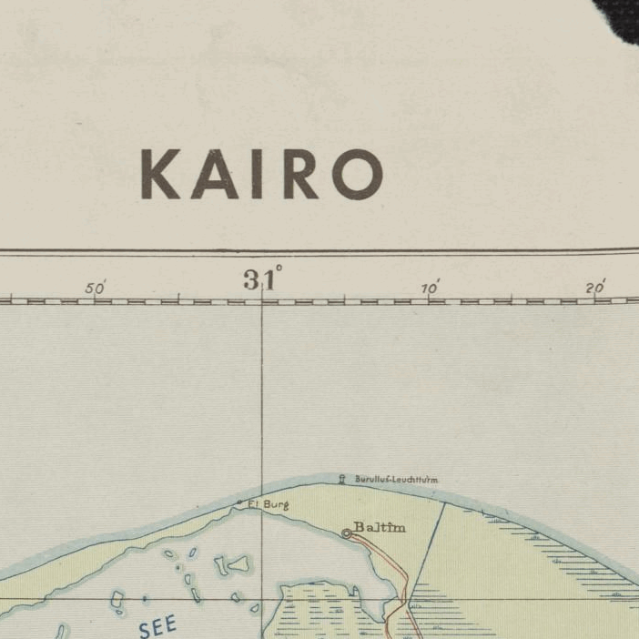
Kairo Ägypten 1941
Kairo Ägypten 1941
From: EGP460.00
This Kharita™ reveals cultural features shown by symbols, location of permanent water supplies and agricultural land (shown in green) in margin. Relief shown by gradient tints, hachures, contours, and spot heights. The map was reissued during Second World War by either the US Army, the British Army or the Italian Army under the Egyptian Maslahat al-Misahah
Map Info
Creator: Maslahat al-Misahah
Date: 1941
Language(s): German
Scale: 1:500,000
Location: Egypt
| Size | 38 x 28.5, 57 x 38, 76 x 57 |
|---|
People Also Purchased
-
Postage Stamps Stickers
EGP90.00 -
Frame
From: EGP250.00 -
Postcards Egypt 1826
EGP50.00 -
Magnifying Glass
EGP120.00
Related products
-
City of Manila & Vicinity 1955
From: EGP460.00 -
Commercial Map of the Near East 1921
From: EGP460.00 -
Damas 1939
From: EGP460.00 -
Damascus 1916
From: EGP460.00 -
Damietta 1941
From: EGP460.00 -
Geological Map of Anatolia 1920
From: EGP460.00 -
Geology of the Kingdom of Saudi Arabia 1958
From: EGP460.00 -
Himalayas 1951
From: EGP460.00 -
Japanese Map of China 1909
From: EGP460.00 -
Jerusalem 1942
From: EGP460.00 -
Lebanon 1926
From: EGP460.00 -
Map of Cairo Showing Mohammedan Monuments 1950
From: EGP460.00


