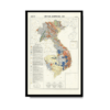
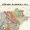
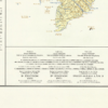
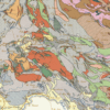
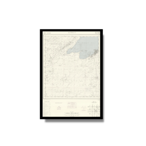
This Geological Kharita™ map of Vietnam, Cambodia and Laos (comprising the former colony of French Indochina) was created in 1971 during the Vietnam war. showing international boundaries, transportation, water features and populated places. Insets map shows Paracel and Spratly Islands. Includes glossary.
The map is interesting in that it is portrayed in both English, Vietnamese and French, which is seemingly a common pattern in vietnamese maps during this period. Relief shown by contours, gradient tints, and spot heights. Depths shown by gradient tints and soundings.
Map Info
Creator: Henri Fontaine
Date: 1971
Language(s): Vietnamese, English, French
Scale: 1:2,000,000
Location: Vietnam, Cambodia, Laos
✪ Heavyweight matte paper at 150 g/sqm
✪ Frame not included
✪ Package comes with shipping tube
NOTICE: International Shipping Temporarily On Hold.
After you place an order, you will receive an email confirming that we have received your order and are processing it. Orders usually take 2–12 business days to arrive.
We do not offer refunds on our maps as they are printed per order. You may request an exchange within 30 days if the item is in good condition.
Visit our Shipping & Returns page for more details.
 Skip to content