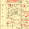
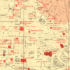
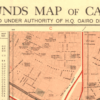
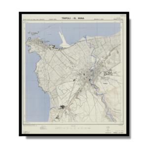
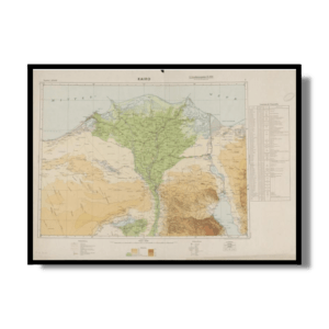
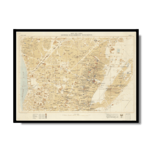
This historically rich Kharita™ shows a section of modern Cairo in 1946, focusing on the downtown area or roughly what came to be called Wist al-Balad—the middle-of-the-city.
It was created as a resource for British Soldiers stationed in Cairo, the map offers remarkable insights into British military life in Cairo during WWII. The colour coding defines zones permitted to British personnel and those that were strictly off limits. The white zones at the center of the map highlight where British soldiers could move freely, while pink zones were ‘out-of-bounds’. The red buildings highlights sites of interest for British personnel, Including, cinemas, the Royal Opera House, the Y.M.C.A, numerous clubs, and the headquarters of British troops in Egypt.
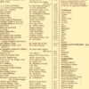
Map Info
Creator: Great British War Office
Date: 1946
Language(s): English
Scale: 1:5,000
Location: Cairo, Egypt
✪ Heavyweight matte paper at 150 g/sqm
✪ Frame not included
✪ Package comes with shipping tube
NOTICE: International Shipping Temporarily On Hold.
After you place an order, you will receive an email confirming that we have received your order and are processing it. Orders usually take 2–12 business days to arrive.
We do not offer refunds on our maps as they are printed per order. You may request an exchange within 30 days if the item is in good condition.
Visit our Shipping & Returns page for more details.
 Skip to content