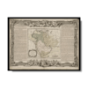
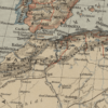
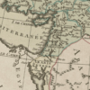
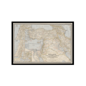
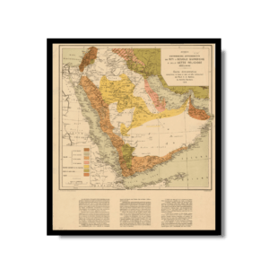
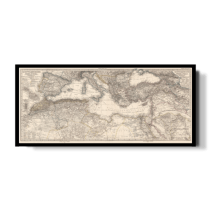
This appealing Kharita™ of the Middle East and Arabia by Brion de la Tour, covers the Arabian peninsula as well as Turkey, Cyprus, Armenia, Iran, Egypt, (Political divisions are color coded) The map notes some important early places including Babylon, Media, Assyria, Mesopotamia, etc. as well as important rivers and mountains.
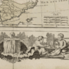
This map also features a detailed explanation of the geographic and political theatre in the region which is surrounded by Brion de la Tour’s elaborate rococo border work and title cartouche. This map was prepared by Brion de la Tour and published in Louis Charles Desnos’ Geographie Moderne, Historique et Politique.
Map Info
Creator: Brion de la Tour
Date: 1766
Language(s): French
Scale: –
Location: Arabian Peninsula
✪ Heavyweight matte paper at 150 g/sqm
✪ Frame not included
✪ Package comes with shipping tube
NOTICE: International Shipping Temporarily On Hold.
After you place an order, you will receive an email confirming that we have received your order and are processing it. Orders usually take 2–12 business days to arrive.
We do not offer refunds on our maps as they are printed per order. You may request an exchange within 30 days if the item is in good condition.
Visit our Shipping & Returns page for more details.
 Skip to content