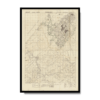
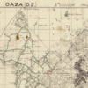
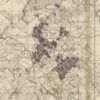
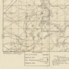
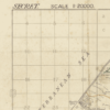
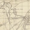
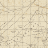
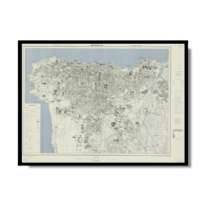
This is a topographic Kharita™ of Gaza, created by the Great British War Office during World War I (1914 – 1918), as can be seen by the green lines which represent British trenches, The map also shows transportation, habitation, vegetation, and religious buildings, as well as symbols, reference, and an index to adjoining sheets.
Relief shown by contours, spot heights, and landform drawings.
Map Info
Creator: Great British War Office
Date: 1917
Language(s): English
Scale: 1:20,000
Location: Gaza Palestine
✪ Heavyweight matte paper at 150 g/sqm
✪ Frame not included
✪ Package comes with shipping tube
NOTICE: International Shipping Temporarily On Hold.
After you place an order, you will receive an email confirming that we have received your order and are processing it. Orders usually take 2–12 business days to arrive.
We do not offer refunds on our maps as they are printed per order. You may request an exchange within 30 days if the item is in good condition.
Visit our Shipping & Returns page for more details.
 Skip to content