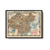
Pictorial Map of China 1931
Pictorial Map of China 1931
From: EGP460.00
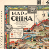
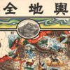
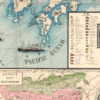
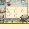
This vibrant pictorial Kharita™ is a pictrial map of China cartographed by Primakoff, G and hand engraved by Sergeeff, P.. The map was published in 1931 by the Northern Trading Company, and is a living testament to the beautiful craft of cartography. Besides “Map of China”, the map is also titled in Chinese with”象形中華民國人物輿地全圖’ which roughly translates to the same thing.
2 inset map show January and July isotherms.
Map Info
Creator: Sergeeff, P., Primakoff, G.
Date: 1931
Language(s): English/Chinese
Scale: –
Location: World
| Size | A3, A2, A1, A0 |
|---|
People Also Purchased
-
Postage Stamps Stickers
EGP90.00 -
Postcards Egypt 1826
EGP50.00 -
Frame
From: EGP250.00 -
Magnifying Glass
EGP120.00
Related products
-
Aden 1949
From: EGP460.00 -
Bible Lands & The Cradle of Western Civilization 1946
From: EGP460.00 -
Catholic Missions in Northeastern Africa 1899
From: EGP460.00 -
Commercial Map of the Near East 1921
From: EGP460.00 -
Damas 1939
From: EGP460.00 -
Damietta 1941
From: EGP460.00 -
Geology of the Kingdom of Saudi Arabia 1958
From: EGP460.00 -
Iran-Iraq: Basra 1942
From: EGP460.00 -
Japanese Map of China 1909
From: EGP460.00 -
Kairo Ägypten 1941
From: EGP460.00 -
Khartoum 1952
From: EGP460.00 -
Kuala Lumpur 1957
From: EGP460.00


