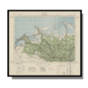
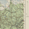
Alexandria 1933
Alexandria 1933
From: EGP460.00
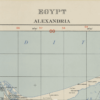
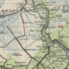
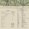
This striking Kharita™ was created by the Great British War Office in 1933. It reveals Alexandria’s roads, tracks, canals, wells, swamps, cities and localities, boundaries, telephone lines, water features, mosques and more.
Map Info
Creator: Great British War Office
Date: 1933
Language(s): English
Scale: 1:250,000
Location: Alexandria, Egypt
| Size | A3, A2, A1, A0 |
|---|
SKU
N/A
Categories All Kharita's, Maps by British War Office, North Africa Maps Tags 20th Century, Egypt
People Also Purchased
-
Postage Stamps Stickers
EGP90.00 -
Postcards Egypt 1826
EGP50.00 -
Frame
From: EGP250.00 -
Magnifying Glass
EGP120.00
Related products
-
A New Map of Cairo 1966
From: EGP460.00 -
Aden 1949
From: EGP460.00 -
City of Manila & Vicinity 1955
From: EGP460.00 -
Classified Map of Secret Nazi Transport Routes 1941
From: EGP460.00 -
Eastern & Western Hemispheres 1905
From: EGP460.00 -
El Mina – Tripoli 1958
From: EGP460.00 -
Iran Natural Vegetation 1960-1972
From: EGP460.00 -
Iran-Iraq: Basra 1942
From: EGP460.00 -
Khartoum 1952
From: EGP460.00 -
Lebanon 1926
From: EGP460.00 -
Map of Arab League States 1960
From: EGP460.00 -
Map of Cairo 1914
From: EGP460.00


