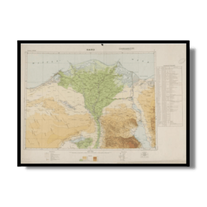
This historically insightful Kharita™, developed by Maslahat Al-Misahah in 1950 shows Islamic buildings and tombs in Cairo for six periods including: Pre-Faṭimid and Faṭimid periods, Aiyūbid period, Baḥrite Mameluke period, Circassian Mameluke period, Turkish period, Post Turkish period (colour coded, key in the bottom left)
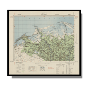
Relief selectively shown by hachures and shading.
Map Info
Creator: Maslahat Al-Misahah
Date: 1950
Language(s): English & Arabic
Scale: 1:5,000
Location: Cairo, Egypt
✪ Heavyweight matte paper at 150 g/sqm
✪ Frame not included
✪ Package comes with shipping tube
NOTICE: International Shipping Temporarily On Hold.
After you place an order, you will receive an email confirming that we have received your order and are processing it. Orders usually take 2–12 business days to arrive.
We do not offer refunds on our maps as they are printed per order. You may request an exchange within 30 days if the item is in good condition.
Visit our Shipping & Returns page for more details.
 Skip to content