In Cairo, on March 22, 1945, the six already sovereign Arab states (Egypt, Syria, Transjordan (later Jordan), Lebanon and Saudi Arabia) formed the Arab League.
At the time the leader of the Arab World
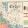
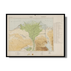
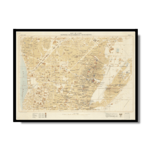
was Egypt’s ultra-charismatic, Pan-Arabist, Soviet-allied President, Gamal Abdel Nasser. In this context, This Kharita™ is created. It is a powerful propaganda work, showcasing Iraq’s supposedly leading role within the Arab World. Published in Baghdad at the beginning of the 1960s, the map was commissioned by Abd al-Karim Qasim (1914 – 1963), the Prime Minister of Iraq who seemed to challenge Nasser’s for his superiority over the Arab World. The map embraces the entire Arab World from Morocco to Oman, and is augmented by a detailed plan of Baghdad bearing a portrait of Qasim, while the flags of the 15 Arab entities adorn the side panels.
There is no mention of Israel (which was then not recognized by any Arab state), with ‘Palestine’ taking up its entire territory. The rest of the national boundaries are conventional, save for the fact that the north of Morocco is shown to still belong to Spain, even though that territory had been claimed by Spain in 1956. The map labels national capitals, other major cities, as well as all major roads, railways and oil pipelines.
This map is considered to be extremely rare, possibly the last remaining, as it would have been intentionally destroyed by the Ba’athist regime that ruled Iraq from 1963 to 2003 that would not have looked favorably upon any document that glorified Qasim.
Map Info
Creator: دار الخط العربي DAR AL-KHAT AL-ARABY
Date: 1960
Language(s): Arabic
Scale: 1:8500000
Location: Middle East & North Africa
✪ Heavyweight matte paper at 150 g/sqm
✪ Frame not included
✪ Package comes with shipping tube
NOTICE: International Shipping Temporarily On Hold.
After you place an order, you will receive an email confirming that we have received your order and are processing it. Orders usually take 2–12 business days to arrive.
We do not offer refunds on our maps as they are printed per order. You may request an exchange within 30 days if the item is in good condition.
Visit our Shipping & Returns page for more details.
 Skip to content