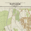
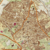
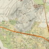
Soviet Map of Marrakech 1973
From: EGP460.00
This Kharita™ was created by the Soviet Government in 1973, it is a military topographic map of Marrakesh showing government, military, transportation, and industrial facilities. Relief shown by contours and spot heights. Depths shown by bathymetric isolines and soundings.
During the Cold War, the Soviet military undertook a secret mapping program that’s only recently come to light in the West. Military cartographers created hundreds of thousands of maps and filled them with detailed notes on the terrain and infrastructure of every place on Earth. It was one of the greatest mapping endeavors the world has ever seen. Read More
Map Info
Creator: Soviet Government
Date: 1973
Language(s): Russian
Scale: 1:10 000
Location: Central Asia
| Size | A3, A2, A1, A0 |
|---|
People Also Purchased
-
Postage Stamps Stickers
EGP90.00 -
Postcards Egypt 1826
EGP50.00 -
Frame
From: EGP250.00 -
Magnifying Glass
EGP120.00
Related products
-
Alexandria 1933
From: EGP460.00 -
Antarctica 1912
From: EGP460.00 -
Beyrouth 1961
From: EGP460.00 -
Bounds Map of Cairo 1946
From: EGP460.00 -
Catholic Missions in Northeastern Africa 1899
From: EGP460.00 -
Damas 1939
From: EGP460.00 -
Damietta 1941
From: EGP460.00 -
El Mina – Tripoli 1958
From: EGP460.00 -
Gaza 1917
From: EGP460.00 -
Guide Plan of Cairo 1949
From: EGP460.00 -
Iran-Iraq: Basra 1942
From: EGP460.00 -
Lebanon 1926
From: EGP460.00


