Himalayas 1951
Himalayas 1951
From: EGP460.00
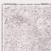
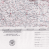
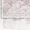
This Kharita, created by the U.S. Air Force in 1951, gives a detailed lithographic view of northern reaches of India, the Himalayas, beyond Tibet and into the southern reaches of the U.S.S.R. It also includes a vast portion of China, Mongolia and neighboring nations of Bhutan, Burma and neighboring lands to the south.
Map Info
Creator: U.S. Air Force
Date: 1951
Language(s): English
Scale: 1:2,000,000
Location: Himalayas
| Size | A3, A2, A1, A0 |
|---|
People Also Purchased
-
Postage Stamps Stickers
EGP90.00 -
Frame
From: EGP250.00 -
Postcards Egypt 1826
EGP50.00 -
Magnifying Glass
EGP120.00
Related products
-
Alexandria 1933
From: EGP460.00 -
Beyrouth 1961
From: EGP460.00 -
Bible Lands & The Cradle of Western Civilization 1946
From: EGP460.00 -
Bounds Map of Cairo 1946
From: EGP460.00 -
Classified Map of Secret Nazi Transport Routes 1941
From: EGP460.00 -
Damas 1939
From: EGP460.00 -
Damascus 1916
From: EGP460.00 -
Damietta 1941
From: EGP460.00 -
El Mina – Tripoli 1958
From: EGP460.00 -
Guide Plan of Cairo 1949
From: EGP460.00 -
Iran-Iraq: Basra 1942
From: EGP460.00 -
Map of Cairo 1914
From: EGP460.00


