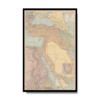
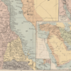
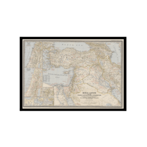
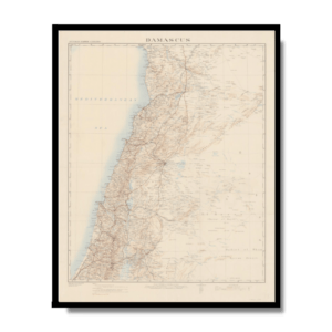
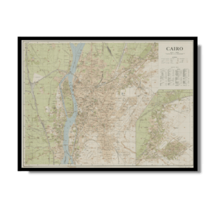
This Kharita™ of the Middle East was published in London 1918. It shows Anatolia, Egypt, and the Arabian Desert. The map was issued at the end of World War I, before the division of Ottoman territories by the League of Nations. Armenia is shown to cover a large portion of Asia Minor. The Strait of Hormuz at the entrance to the Persian Gulf is marked as “Pirate Coast.” The present-day states of the Persian Gulf states are labeled “East India Co (Brit).” Railroad routes, both actual and proposed, roads, and tracks are marked. Inset maps depict the Sinai Peninsula and surrounding countries and the wider Southwest Asia region.
Map Info
Creator: Gross, Alexander
Date: 1916
Language(s): English
Scale: approximately 1:4,500,000
Location: Middle East
✪ Heavyweight matte paper at 150 g/sqm
✪ Frame not included
✪ Package comes with shipping tube
NOTICE: International Shipping Temporarily On Hold.
After you place an order, you will receive an email confirming that we have received your order and are processing it. Orders usually take 2–12 business days to arrive.
We do not offer refunds on our maps as they are printed per order. You may request an exchange within 30 days if the item is in good condition.
Visit our Shipping & Returns page for more details.
 Skip to content