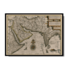
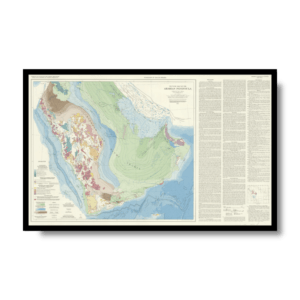
Jan Huygen van Linschoten (1563-1611) was a Dutchman whose contributions to cartography were of great significance in breaking the Portuguese monopoly on trade and navigation in the late 16th century and in opening up southern Asia to the Dutch and later the English. As a young man, van Linschoten spent four years in Spain learning trade. He then made his way to Lisbon, where he was taken on by the archbishop of Goa, the capital of the “Portuguese State of India.” The Portuguese were the only Europeans who knew the safe navigation routes to the East, which they regarded as closely guarded national secrets upon which their wealth depended. Van Linschoten was in Goa in 1583-88, during which time he gained much nautical and mercantile knowledge.
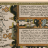
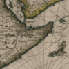
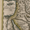
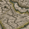
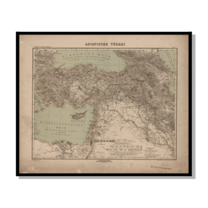
On his voyage home he was shipwrecked in the Azores, where he had time to write an account of his travels. He is best known for his magnum opus Itinerario, first published in Amsterdam in 1596, of which this map forms part. The shape of the Arabian Peninsula, including the whole of Arabia, is far more accurate here than on any earlier map. Julfar (present-day Ras al-Khaimah, United Arab Emirates) is indicated for the first time. The arrowhead-shaped Qatar Peninsula, called Catura, is clearly distinguishable, located in the midst of an oyster-bed represented by small pearl-dots. Inscriptions proclaim that the map shows “the location of the gulfs and of the islands, the cliffs, raised earths, shallows, and [their] depths, that are close to these shores, with correct names for the single places, as it is required by the very expert Lusitanian pilots of ships: revised with great accuracy from excellent Indian maps, and corrected throughout.” Distance scales are given in Spanish leagues and German miles.
Map Info
Creator: Jan Huygen van Linschoten
Date: 1858
Language(s): English
Scale: 1:45,000,000
Location: South West Asia
✪ Heavyweight matte paper at 150 g/sqm
✪ Frame not included
✪ Package comes with shipping tube
NOTICE: International Shipping Temporarily On Hold.
After you place an order, you will receive an email confirming that we have received your order and are processing it. Orders usually take 2–12 business days to arrive.
We do not offer refunds on our maps as they are printed per order. You may request an exchange within 30 days if the item is in good condition.
Visit our Shipping & Returns page for more details.
 Skip to content