Damietta 1941
Damietta 1941
From: EGP460.00
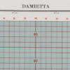
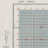
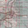
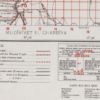
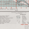
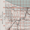
This Kharita™ was created by the Great British War Office in 1941, and would’ve been limited to war and navy use only. This map showcases Damietta’s, railways, government buildings, villages, banks, canals, bridges, mosques, churches, synagogues, telegram offices and more.
On the left side of the map a reference point is shown highlighting the declination of magnetic north and revealing true north
Map Info
Creator: Great British War Office
Date: 1941
Language(s): English
Scale: 1:100,000
Location: Damietta, Egypt
| Size | A3, A2, A1, A0 |
|---|
SKU
N/A
Categories All Kharita's, Maps by British War Office, North Africa Maps Tags 20th Century, Egypt
People Also Purchased
-
Postage Stamps Stickers
EGP90.00 -
Frame
From: EGP250.00 -
Postcards Egypt 1826
EGP50.00 -
Magnifying Glass
EGP120.00
Related products
-
Aden 1949
From: EGP460.00 -
Antarctica 1912
From: EGP460.00 -
City of Manila & Vicinity 1955
From: EGP460.00 -
Commercial Map of the Near East 1921
From: EGP460.00 -
Eastern & Western Hemispheres 1905
From: EGP460.00 -
El Mina – Tripoli 1958
From: EGP460.00 -
Geology of the Kingdom of Saudi Arabia 1958
From: EGP460.00 -
Himalayas 1951
From: EGP460.00 -
Iran-Iraq: Basra 1942
From: EGP460.00 -
Japanese Map of China 1909
From: EGP460.00 -
Kuwait 1958
From: EGP460.00 -
Map of Cairo 1914
From: EGP460.00


