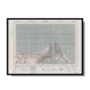
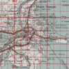
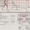
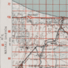
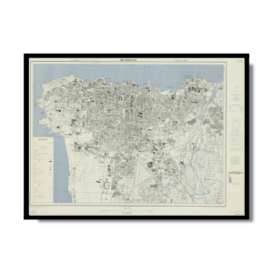
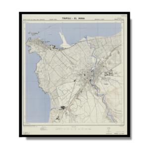
This Kharita™ was created by the Great British War Office in 1941, and would’ve been limited to war and navy use only. This map showcases Damietta’s, railways, government buildings, villages, banks, canals, bridges, mosques, churches, synagogues, telegram offices and more.
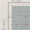
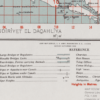
On the left side of the map a reference point is shown highlighting the declination of magnetic north and revealing true north
Map Info
Creator: Great British War Office
Date: 1941
Language(s): English
Scale: 1:100,000
Location: Damietta, Egypt
✪ Heavyweight matte paper at 150 g/sqm
✪ Frame not included
✪ Package comes with shipping tube
NOTICE: International Shipping Temporarily On Hold.
After you place an order, you will receive an email confirming that we have received your order and are processing it. Orders usually take 2–12 business days to arrive.
We do not offer refunds on our maps as they are printed per order. You may request an exchange within 30 days if the item is in good condition.
Visit our Shipping & Returns page for more details.
 Skip to content