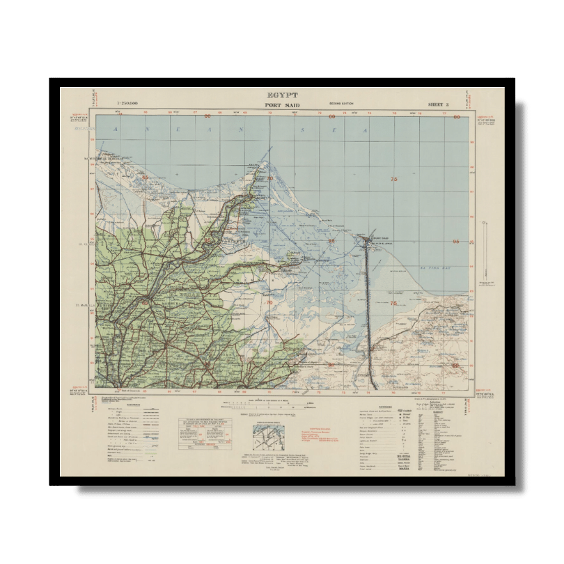
Port Said 1941
Port Said 1941
From: EGP460.00
This Kharita™ was created by the Great British War Office in 1941 for military use. It is Topographic and covers the Suez Canal and parts of the Delta. It also shows sand, sand dunes, railways, roads (3 categories), canals and wells. Relief is shown by contours and spot heights.
Map Info
Creator: Great British War Office
Date: 1941
Language(s): English
Scale: 1:250,000
Location: Port Said, Egypt
| Size | A3, A2, A1, A0 |
|---|
SKU
N/A
Categories All Kharita's, Maps by British War Office, North Africa Maps, Visually Aesthetic Maps Tags 20th Century, Egypt
People Also Purchased
-
Postage Stamps Stickers
EGP90.00 -
Postcards Egypt 1826
EGP50.00 -
Frame
From: EGP250.00 -
Magnifying Glass
EGP120.00
Related products
-
Algérie et Tunisie 1890-1892
From: EGP460.00 -
Asian Turkey 1895
From: EGP460.00 -
Iran-Iraq: Basra 1942
From: EGP460.00 -
Kairo Ägypten 1941
From: EGP460.00 -
Lebanon 1926
From: EGP460.00 -
Map of Northern Sinai 1914
From: EGP460.00 -
Middle & North Africa 1830
From: EGP460.00 -
Northern Morocco 1950
From: EGP460.00 -
Partition of Palestine 1949
From: EGP460.00 -
Soviet Map of Casablanca 1972
From: EGP460.00 -
Soviet Map of Tripoli 1985 [Set of 2]
From: EGP660.00 -
The Daily Telegraph: War Map of Egypt and the Near East 1918
From: EGP460.00


![Soviet Map of Tripoli 1985 [Set of 2]](https://mykharita.com/wp-content/uploads/2024/03/45-1-300x300.png 300w, https://mykharita.com/wp-content/uploads/2024/03/45-1-150x150.png 150w, https://mykharita.com/wp-content/uploads/2024/03/45-1-768x768.png 768w, https://mykharita.com/wp-content/uploads/2024/03/45-1-600x600.png 600w, https://mykharita.com/wp-content/uploads/2024/03/45-1-100x100.png 100w, https://mykharita.com/wp-content/uploads/2024/03/45-1.png 810w)

