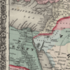
South-West Asia 1858
South-West Asia 1858
From: EGP460.00
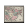
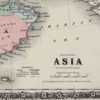
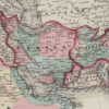
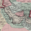
This Kharita™ shows the Arabian Peninsula, Persia (present-day Iran), Afghanistan, and Baluchistan (present-day Iran and Pakistan) was created in 1858 by American cartographer, J.H. Colton.
Coloring is used to indicate borders and certain provinces or settled areas. The map shows cities, mountains, and roads, and includes some notes on topographical features. The map appeared in other editions of Colton’s General Atlas and reflects the general level of geographic knowledge of the Middle East in mid-19th-century America. The map is decorated by Colton’s trademark borders of intertwining vines and flowers
Map Info
Creator: Colton, G. Woolworth
Date: 1858
Language(s): English
Scale: 1:45,000,000
Location: South West Asia
| Size | A3, A2, A1, A0 |
|---|
SKU
N/A
Categories All Kharita's, Gulf Maps, Regional Maps Tags 19th Century, Afghanistan, Egypt, Iran, Iraq, Jordan, Kuwait, Lebanon, Middle East, Oman, Palestine, Qatar, Regional Map, Syria, Turkey, UAE, Yemen
People Also Purchased
-
Postage Stamps Stickers
EGP90.00 -
Postcards Egypt 1826
EGP50.00 -
Frame
From: EGP250.00 -
Magnifying Glass
EGP120.00
Related products
-
Antarctica 1912
From: EGP460.00 -
Birds Eye View of the Suez Canal 1882
From: EGP460.00 -
Commercial Map of the Near East 1921
From: EGP460.00 -
Lebanon 1926
From: EGP460.00 -
Map of Northern Sinai 1914
From: EGP460.00 -
Northern Morocco 1950
From: EGP460.00 -
Orographic map of the Dardanelles 1915
From: EGP460.00 -
Palästina 1926
From: EGP460.00 -
Political Map of Africa 1917
From: EGP460.00 -
Port Said 1941
From: EGP460.00 -
Soviet Map of Basra 1979
From: EGP460.00 -
Soviet Map of Marrakech 1973
From: EGP460.00


