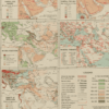
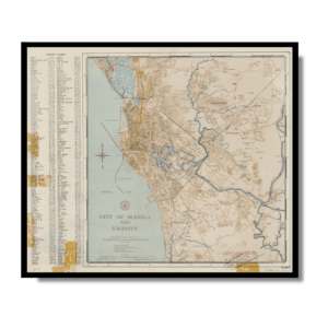
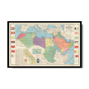
This insightful Kharita™, issued by the Irving National Bank in 1921, was used by businessman in order to understand the geo-economical landscape of the middle east (also knows as the near east) This map shows local agriculture, fisheriees, natural and mineral resources, major cities, chief seaports, direction of trade, principal railways, and navigable rivers. The map is color–coded to show terrain features that effect trade, including deserts and marshlands, lands below sea level, lowlands, uplands and plateaus, older worn down mountains, and younger rugged mountains as well as highlighting the major trade centers in the region
Map Info
Creator: General Drafting Company
Date: 1921
Language(s): English
Scale: approximately 1:5,480,000 – 1:8,500,000
Location: Middle East
✪ Heavyweight matte paper at 150 g/sqm
✪ Frame not included
✪ Package comes with shipping tube
NOTICE: International Shipping Temporarily On Hold.
After you place an order, you will receive an email confirming that we have received your order and are processing it. Orders usually take 2–12 business days to arrive.
We do not offer refunds on our maps as they are printed per order. You may request an exchange within 30 days if the item is in good condition.
Visit our Shipping & Returns page for more details.
 Skip to content