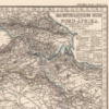
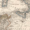
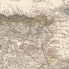
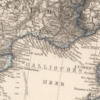
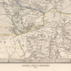
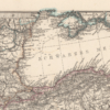
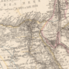
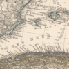
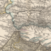
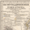
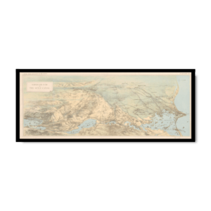
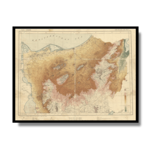
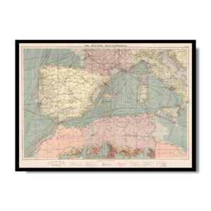
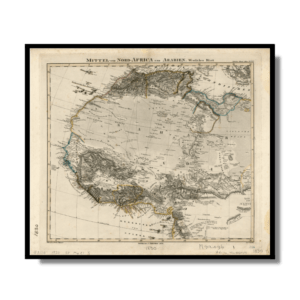
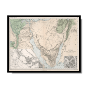
This Kharita™ is part of Adolf Stieler’s Hand atlas of the world and of the universe. Published by Justus Perthes of Gotha. It went through ten editions from 1816 to 1945. The first edition, published in 1817 by Stieler and Christian Gottlieb Reichard, with editions continuing well into the 20th century. This is the 6th. edition, with 90 maps dated 1871–75, edited by August Petermann, Hermann Berghaus and Carl Vogel.
This copy depicts the Mediterranean stretching from morocco to as far as iran. The Map shows political and administrative boundaries, cities, roads, railroads, canals, rivers, lakes, and mountains. Also showing European possessions and exploration routes.
Relief shown by hachures and spot heights. Depths showing by soundings. Prime meridians: Greenwich, Ferro and Paris. Includes legend, text, profiles, and color coded references.
Map Info
Creator: Adolf Stieler
Date: 1875
Language(s): German
Scale: 1:7,500,000
Location: Mediterranean
✪ Heavyweight matte paper at 150 g/sqm
✪ Frame not included
✪ Package comes with shipping tube
NOTICE: International Shipping Temporarily On Hold.
After you place an order, you will receive an email confirming that we have received your order and are processing it. Orders usually take 2–12 business days to arrive.
We do not offer refunds on our maps as they are printed per order. You may request an exchange within 30 days if the item is in good condition.
Visit our Shipping & Returns page for more details.
 Skip to content