Viet-nam, Kampuchia, Lao 1971
Viet-nam, Kampuchia, Lao 1971
From: EGP460.00
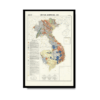
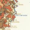
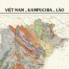
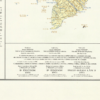
This Geological Kharita™ map of Vietnam, Cambodia and Laos (comprising the former colony of French Indochina) was created in 1971 during the Vietnam war. showing international boundaries, transportation, water features and populated places. Insets map shows Paracel and Spratly Islands. Includes glossary.
The map is interesting in that it is portrayed in both English, Vietnamese and French, which is seemingly a common pattern in vietnamese maps during this period. Relief shown by contours, gradient tints, and spot heights. Depths shown by gradient tints and soundings.
Map Info
Creator: Henri Fontaine
Date: 1971
Language(s): Vietnamese, English, French
Scale: 1:2,000,000
Location: Vietnam, Cambodia, Laos
| Size | A3, A2, A1, A0 |
|---|
People Also Purchased
-
Postage Stamps Stickers
EGP90.00 -
Frame
From: EGP250.00 -
Postcards Egypt 1826
EGP50.00 -
Magnifying Glass
EGP120.00
Related products
-
Alexandria 1933
From: EGP460.00 -
Antarctica 1912
From: EGP460.00 -
Beyrouth 1961
From: EGP460.00 -
Bounds Map of Cairo 1946
From: EGP460.00 -
Catholic Missions in Northeastern Africa 1899
From: EGP460.00 -
Classified Map of Secret Nazi Transport Routes 1941
From: EGP460.00 -
Damas 1939
From: EGP460.00 -
Damascus 1916
From: EGP460.00 -
Eastern & Western Hemispheres 1905
From: EGP460.00 -
Gaza 1917
From: EGP460.00 -
Japanese Map of China 1909
From: EGP460.00 -
Kuwait 1958
From: EGP460.00


